You Are Responsible!!!
Recently,
I happened to interview a GIS Analyst for some GIS work. I inquired about
his approach to calculate a distance between two points with coordinates (x1,
y1) and (x2,y2). He showed me ways through
attribute tables, measuring tools, Google Earth, GPS and finally a formula:
Width = Area / Length… that’s when it really struck me.
I’ve come across many other GIS Graduates and GIS Professionals criticizing the lack of job opportunities amid multi-billion dollar projects like CPEC, renewable Energy, Housing and other infra structure which are under execution in Pakistan. Another point of their debate focuses more specifically on their “GIS Skills” going unnoticed in this modern age of technology and tools.
So, what really is
happening? Who is actually responsible here?
GIS
started off when it was still an immature, not-very-user-friendly technology,
and few people knew how to use it. Publishers and Academia supported early GIS
developments. Steadily with time, and with the realization
of “Data”, “GUI” and “Usability”, the scope of geospatial data manipulation and
visualization flourished. Various organizations began supporting subsets of the
GIS Profession. This article, which offers my perspective only, will hopefully
provide some understanding of how GIS is treated and, perhaps, provoke some
thought in those who began their careers with GIS as well.
Maybe
we have lost sight of what actually is the need in the increasingly competitive
nature of GIS and its advanced functionality. I may not question the potential
and abilities of GIS professionals to address the challenges faced in the
industry. I may not even speak for the recruiters and employers. I most
certainly do not question the academia. However, I would definitely re-direct
their attentions to critically assess themselves.
It
seems proper to initiate with a self-analysis. My career jump started as a
Survey Engineer, establishing control networks and topographic surveys using Trimble
4000 SSI DGPS. A vital part of myregular workflow was to overlay the survey
data on a Landsat ETM Image. Obviously, this could be done by adding a Raster
file (Layer Stacked TIFF Image) and processed survey data files (DXF points
& polylines) in an ArcGIS document. On the contrary, at that time I was only
proficient in AutoCAD and AutoCAD Customization using programming skills in
AutoLISP and VBA.
I
can still recall the overwhelming excitement the day when I got hold of ArcGIS
8.0 in a CD. The anxiety and giddiness just before installing it in my computer
for the first time. The sensation of invincibility rising with the progress of
installation whispering that I’ll soon be ready to take on the world. Finally
when it was installed, the feeling of confidence skyrocketing like I’ve got
this on lock now and nothing can stop me…and suddenly the immediate realization
of a black hole …Readers who are proficient in CAD, can realize how difficult
and challenging it is for a CAD user to comprehend the GIS environment!
I
owe thanks to the magic of “F1”for opening windows of knowledge (standard help
CHM files) and Yahoo search (Google was not born yet). I started to learn about
ArcGIS. The Spatial Analysis, SQL queries on attribute tables, 3D analysis and
cartographic layouts were so interesting, fascinating and motivating to probe
more into GIS and this lead to a better understanding and grip on ArcGIS. I
gained popularity, slow and steady, among colleagues and coworkers as a GIS
Analyst / GIS Specialist.
I
applied for the post of GIS Analyst in one of the top ranking Engineering
Consulting Firms of Pakistan. This was somewhere back in 2006, and the job
advertisement published in newspaper indicated a mandatory degree in GIS and
remote sensing for the applicants. I had applied with the shortcoming of a GIS
related degree. Surprisingly, I was shortlisted and called for an interview. I
managed to get through the interviewers who acknowledged my skills of Geodetic
Survey and the proficiency I had in GIS. I got the job with a tailor-fitted
designation of a“GIS Engineer”. After 16 months of making ArcGIS layouts,
digitization, attribute editing with tedious repetition and no further creative
or innovative task at hand to challenge my own ability, I resigned.
With
all the due regards, it is seen that monotonous work routines usually tend to
create an environment of depression. At times, with office politics, this may
even aggravate to frustration. This paves way to kill any initiative, cause a
serious decline in the learning graph and eventually becomes obstructive
for a flourishing career. When faced with similar circumstances, my priority is
usually to clear the atmosphere. This precisely is the reason that lack of
consistency exists as another trait in my resume. Nevertheless, a new era
dawned after my resignation where I wasn’t limited as an ArcGIS User. I
realized there was much more beyond ArcGIS.

Enough
said, my initiation to GIS was in the golden age for GIS graduates. Many public
and private organizations had started to implement GIS by creating spatial
datasets, maintaining geodatabases and developing applications. Obviously, the
demand for the ArcGIS users was so high as compared to computer science &
IT professionals.
Graduates from space science, geography, mountain research, town planning and other departments were being offered jobs as GIS Analyst, GIS Specialist or a GIS Expert. GIS Education back then was limited to a semi major subject named as Introduction to GIS and Remote Sensing. The course contents of this subject were not beyond the basic understanding and interaction with industry leading products like ESRI, ArcGIS etc. Though not being taught the full range of GIS or remote sensing subjects, it was enough to pursue a career as GIS Professional in industry.
Initially candidates having ArcGIS software experience of 2 to 4 years were considered eligible.

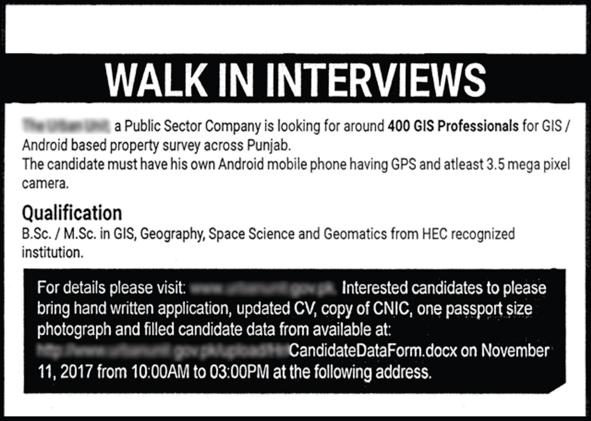
With the passage of time, the eligibility criteria for GIS professionals changed. Hundreds of the GIS professionals were required to be recruited who may hold a Bachelor or a Master’s degree, along with ownership of an android mobile phone with GPS and at least 3.5 mega pixel camera. The advertisement snapshots below show the gradual changes in eligibility criteria as published in local newspapers.


Digitizing the parcels from Google Earth Image
Data entry using Excel
Capturing photos of properties using Android phone
Entering attributes in an android app and editing.
Generating reports based on spatial queries
The above mentioned job description and responsibilities can be considered as a good start for a fresh GIS graduate. However, repeated continuation of such tasks for years gets you nowhere.
Initially candidates having ArcGIS software experience of 2 to 4 years were considered eligible. With the passage of time, the eligibility criteria for GIS professionals changed. Hundreds of the GIS professionals were required to be recruited who may hold a Bachelor or a Master’s degree, along with ownership of an android mobile phone with GPS and at least 3.5 mega pixel camera.
Definitely,
projects like CPEC, infrastructure, studies regarding climatic change and other
mega housing & town planning projects need professionals who can support
and strengthen the engineers, architects, urban planners, geologists,
hydrologists and geodetic survey professionals. But, let’s be practical
here,the factual needs of the time are much more than parcel mapping, attribute
editing or colorful layouts. Spatial data scientists & analysts are
required nowadays who can work cordially with in various other but specific
professional domains.
Property
data collection using Android phones is realistically a non-technical task. I
cannot consider this as the ultimate role of a GIS professional. GIS
professionals should get into Geodetic Surveys where they can work with
emerging technologies such as GNSS systems, Drones, 3D scanners, GPR and other
latest equipment and software.
Geography
is all about the relationships between the geometric objects surrounding us. A
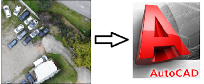
spatial sense can easily gather the geometry in everything and everywhere. CAD
is a platform where geometry can be understood conceptually to utilize the full
potential of GIS abilities. This opens avenues for GIS professionals in the engineering, architecture and construction industry.
3D
modeling is again another vast field. It is not only for the graphic designers
or CAD operators. There is a lot of stuff for GIS professionals to explore.
Unity, Meshlab, Meshmixer, Blender, Revit, Fusion 360 and many more have the
scope to indulge which is equally interesting, fascinating and mesmerizing to
work.
Almost all degree programs include a course of programming or coding. Currently, C++ is being taught but with the emerging trends I would suggest Python, VBA or Javascript to be included for enhanced usefulness in rather practical fields. Either you are working in ArcGIS or QGIS or any image processing software, python is the best option to start learning programming.
There
are several image processing software which can be interesting and explorable
by GIS professionals. Matlab was a personal but productive experience while
designing filters, processing different bands of images with morphological
operators and writing different algorithms to process images. It actually
helped me comprehend major image interpretation and image processing tasks done
in top ranked image processing packages like ERDAS Imagine, ENVI, PCI Geomatica
and others.
Property data collection using Android phones is realistically a non-technical task. I cannot consider this as the ultimate role of a GIS professional. GIS professionals should get into Geodetic Surveys where they can work with emerging technologies such as GNSS systems, Drones, 3D scanners, GPR and other latest equipment and software.
Unfortunately, majority of GIS professionals have spent more than a decade in organizations doing very basic tasks. They could not realize the advancements and exponential change of technology. Their skill set is still limited to ArcGIS software.
They could not explore the new industry standards, emerging technologies and software. Undeniably,the academia is dependable to some extent in playing an effective role by revising not only the curriculum but also resources on the basis of market demands. Then again without any exceptions, in my personal opinion, these GIS professionals themselves are responsible since the following options always exist for them to bridge the gap:
Grab opportunities to learn new things.
Expand and improve their typical skill set.
Innovate ideas to compete in the industry.
Apart
from Geodetic Surveys, CAD, 3D modeling, Coding, photogrammetry and image
processing as advanced skills, there are many other noteworthy aspects.
Technology is changing exponentially and to keep pace with the current trends,
nowadays learning is just a click away. What matters most is the dedication an
individual exhibits and the zeal and enthusiasm which drives your own life in a
natural pattern. Where there is a will, there is always a way … and so in
conclusion YOU ARE RESPONSIBLE!!!
Best of luck.


SUPERB, ON THE SPOT.
ReplyDeleteThe presented theme is indeed a beacon of hope for the GIS professionals. #youareresponsible
Interesting and to the point. I agree that gis organizations should focus more on new softwares and technologies, instead of 5 or 6 months digitizing gis professionals must know how to scrape the data online via programming tools and in very short time analysis could be done.
ReplyDeleteI think, the content is missing with "Solutions". The shortcomings are well explained about the GIS Professionals like me.
ReplyDeleteBut, I would like to wait for the next blog where I could get the solutions and some motivation to solve these shortcomings and about the leaning and modern direction of GIS / RS field.
The other expected part about the entrepreneurship was also missing; how you get started your own setup ?; what was your motivation to start your own setup ?; GIS entrepreneurship challenges in Pakistan; Whats your suggestions to New GIS professionals to start their own work of freelancing or a firm ?.
I personally believe that, "Its good to highlight the problems or shortcomings but the seniors persons like you, must suggest the solutions for them also."
Thanks
hm
ReplyDelete