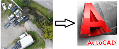
Why GIS users should learn AutoCAD?
My last recent posts are titled with prefix of SpaTools.
SpaTools is a .NET DLL developed using AutoCAD .Net API, where scripts, routines, macros and programs written in VBA and Lisp by me are integrated into a single DLL file using C# Language. The major motives to develop such a DLL and share it with fellow professionals are its portability, scalability and integrity. Till now, tools for clipping objects, extracting topographic profiles from contours, Cut polygons, annotating an alignment with chainages, creating a convex hull, and some others of the simpler sort are included.
SpaTools was tried, tested and appreciated in the CAD community. Feedbacks were received with requests for additional programs/tools to be included. On the contrary, the GIS community was silent. This was awkward since GIS (Geographic Information System) is a “System to Collect, Store, Analyze and represent the Spatial Data”. Following were some views from GIS professionals, upon inquiry:
- They are GIS analysts not draft-men. So, CAD is not considered as an essential part of the job.
- Most of the GIS users are limited to using specific GIS software like ArcGIS and QGIS for producing maps and performing spatial analysis.
- They believe that CAD is essential skill for a GIS professional but they were not taught during their degree programs.
- They are not working in any Engineering, Construction, Architectural firm where CAD is used to design and present the drawings.

CAD and GIS environments share the use of points, lines, and polygons for describing spatial data relationships or providing specific information of location or orientation. A typical road map is the common example of spatial data in both environments. It is a two-dimensional object comprising points, lines, and polygons to represent cities, routes, and political boundaries such as states or provinces.
Although such basic geometric elements are commonly used all the time, the definitions, axioms and propositions of the Euclidean Geometry are hidden in typical GIS software. That is one reason that I consider AutoCAD as the best tool to understand geometry for geospatial solutions and to develop spatial sense. There are several simple AutoCAD commands which demonstrate the construction of geometric objects and their properties in a cognitive way. A few examples to elaborate:
- Demonstrate the conversion of a polyline into polygon by just setting its property Closed = Yes.
- Create a Ray starting from a defined point to an infinite length by simple using “Ray” command
- Create a regular polygon of any number of sides by using “Polygon” command
- Create an ellipse and demonstrate the difference between a circle and ellipse by changing the minor and major radii
- Understand about the arcs by using different methods of Arc construction
|
|
|
|---|


|
|
|---|
")

Then there are practical situations where the data available in the form of CAD drawings is required to be transformed into shapefiles and Geodatabase. Such data may either be the legacy data created and maintained in 90’s or the data now a day from engineering design procedures and workflows. After all, CAD tools are still the best choice for data creation because of their precision, ease of use and the millions of software users who still prefer to work with CAD technology. Such drawing files may be on Local or even undefined coordinate system and datum. To assign a defined global coordinate system to such data prior to loading it into a Geodatabase become a difficult task in absence of Autodesk products such as AutoCAD Map 3D or Autocad Civil 3D, where all the coordinate systems having EPSG codes are integral part and parcels. The coordinate transformations can be done easily without loss of precision using these Autodesk products. Tryout the MAPCSASSIGN command in AutoCAD Map 3D to witness the all coordinate systems and datum used all over the world.
Now I think this is another reason, valid enough, that GIS users should have sufficient knowledge of CAD systems for transforming CAD drawings into GIS coverages. Here AutoCAD gives them the decision power whether to transform an object as a polyline or a polygon with the difference of only a single property named as “Closed”. Similarly, there might be many blocks which have attributes with different data types. The transformation and migration of such complex objects is not just a one click process. In such situation, a GIS user must know about the mechanism of data storage in Cad drawings.
With the emerging technologies such as LIDAR, laser scanning and photogrammetry, now a days, new possibilities for capturing 3D information and 3D modeling of urban cities and terrains are being offered. These include the generation of virtual 3D city models of urban areas where terrain surfaces, sites, buildings, infrastructure landscape elements and other related objects are integrated together. Such technologies and software (Autodesk Revit for BIM, Autodesk Recap, Autodesk Inventor, Fusion 360 etc) need a deep understanding of 3D Cartesian coordinate systems, 3D data structures, 3D file formats and visualization techniques. There is a variety of software used in the industry for 3D modeling such as Meshlab, Sketchup, Unity, Blender, Meshmixer etc. All such software is much complex if one is starting from the scratch to build 3D models. To learn 3D Modeling in easy and fast way, there is no better choice than AutoCAD. Just try Extrude, Sweep, Subtract, Union, Stlout commands to demonstrate the power of AutoCAD in 3D. These basic commands make it easy and fast to build 3D shapes and perform Boolean operations on these objects.
There might be many job opportunities which may require solely GIS skills but these job descriptions are limited to create, develop or maintain an Enterprise GIS System for a particular public or private sector department or organization such as Department of Water supply & Sewerage, Roads & Highways Authority, Electrical Distribution System Corporation etc. On the contrary, there are several job opportunities created by companies & firms working in Civil Engineering, Surveying & Mapping, Architecture, Construction & urban Planning which make it mandatory for a GIS user to have proficient knowledge of CAD systems. Engineers, Architects and surveyors regularly use both GIS and CAD to create maps. The main advantage of using CAD to draw a site plan, map, or profile is a higher level of accuracy. They often need to attach data to the lines, polygons and points in a map to visualize and analyze information. For example, highway engineers need to use GIS to produce a map that shows all the roads labeled according to the condition rating of the pavement. This is not possible to accomplish without GIS software but it also needs the data from CAD to be used as Base Data. A GIS user with the CAD proficiency can have both worlds.
I would suggest readers who are working in academia as teachers, professors and lecturers in GIS education that they should introduce CAD in their syllabus at least as an auxiliary subject so that the GIS graduates can also pursue their career in Engineering, Architecture and Construction industry effectively.


This comment has been removed by the author.
ReplyDeleteGreat article Imran Anees
ReplyDeleteThanks for sharing. I have no doubt that AutoCAD increases and is very significant for GIS users. One more thing you liked about the examples made in AutoCAD, what are the tools / applications you can use to create animations, how to share?
There are online pages which create animated GIFs from screen captured movies like https://ezgif.com/
DeleteWow. Thanks for this article sir.
ReplyDeleteThanks...i am inspired to go deeper on CAD. Can the operation system of both are compatible with each other or can both of the be operated on one computer unit.. My thanks for the clarification
ReplyDeleteThat's great. Highly informative.
ReplyDeleteWaooh, this is a good article. It has been a honour reading your articles.
ReplyDeleteThanks for this one again.
Great and highly informative article Anees. You are true that CAD adds efficiency and save times in creating GIS maps for infrastructure sector. We are using both GIS and CAD to create maps on a regular basis.
ReplyDelete