The Spatial Sense: Pushing Boundaries beyond the Sixth Sense
Quite recently, my son asked me a question “What is the Height of Mount Everest?”, My reply was simple enough “It is 8,848 meters above mean sea level”. It was but the follow-up question which really boggled me, “Who climbed the Mount Everest with GPS to measure the height?”. This for me was a realization of the peculiar nature of kids to know about the world around them. Some other FAQs fairly of a similar sort are:
· How deep is the ocean?
· Where do rocks come from?
· When will humans live in space?
· Why were the numbers made?

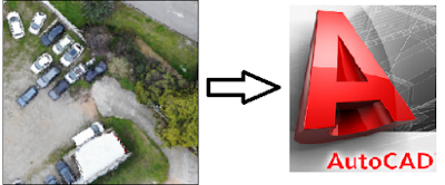
Last week, at an Engineering University, we presented 3D printed models of some dams & hydropower projects under construction in Pakistan. These were appreciated by the visiting industry professionals, faculty members and especially engineering students. The students were highly inquisitive about the tools, skills, technology, 3D rendering software and 3D printers used to build such models and dioramas. The occasion and time were not suitable for queries in detail, my answer had to be generic in a way, …
It just needs Spatial Sense to imagine, visualize, draw and mould them.
The spatial sense, ability, orientation, intelligence, reasoning or insight…whichever term used defines the plain understanding of shape, size, position, direction and movement. This particular understanding is cognitive in nature but it is also an inherent part of our daily lives, which makes us work-out how to move and interact within our environment. We start to learn this skill as children and carry it on with us into our adult years.
Great examples are found in the field of graphics, architecture, surveying, mapping, cartography and other fields of engineering, science & technology where sensitivity to color, line, shape, form, space, and the relationships that exist between these elements is involved. Certain knowledge including the capacity to visualize and to graphically represent visual or spatial ideas is extremely mandatory to design and build incredible things.
Stephen Hawking strongly related Spatial Awareness to Mathematics and Physics in his inspiring and incredible quote as follows…(gender discrimination apart…that is solely his view…I’ve got nothing against it!!!)

The spatial sense is necessity in order to understand the geometric aspects of our environment and the real world around us. Geometry has a very strong connectivity with a multitude of situations faced in the art, the nature, and the things we make. Geometric principles are applied in designing an electronic circuit board, a building, a dress, a bookshelf or even a newspaper page. Carpenters use triangles for structural supports and scientists use geometric models of molecules to provide clues to understand their chemical and physical properties.
So much said, Geometry and Spatial Sense is also a relevant area of mathematics for youngsters, who are naturally curious about the physical world. Questions such as those listed in the opening para should not be ignored or suppressed. Children should be motivated with intensive opportunities from real life situations allowing them to self-explore geometric and spatial concepts. Ann Lewin-Berham (A teacher, educator, author, school founder and children’s museum pioneer) quotes that:

Let us step forth for students to be exposed to a broader range of geometric activities at all grade levels. Let us bridge the gap between the curriculum of geometry in primary/secondary schools through Cognitive Learning (my last blog 😉) and contribute to the spatial sense needed for complex algebra, calculus and analytical geometry in the college/university level.


👍
ReplyDeleteGreat Idea!!! Holistic learning must be introduce in this era of technology.
ReplyDeletenice
ReplyDeletenice idea!
ReplyDelete